
How Does IdentiFlight Work?
IdentiFlight consists of stereo and wide-field-of-view cameras, proprietary software, and neural network technologies that process the images to determine 3D position, velocity, trajectory, and protected species of interest, all in real time.
OVERVIEW
From initial siting to installation and maintenance, IdentiFlight is the only independently validated solution for monitoring and informed curtailment (shutdown on demand) on wind farms.
As opposed to radar technology, IdentiFlight can detect and classify species in real time with 99% accuracy. This is accomplished using a proprietary hybrid of machine vision and neural network technologies that allows users to specify which species of birds are protected – maximizing power generation.
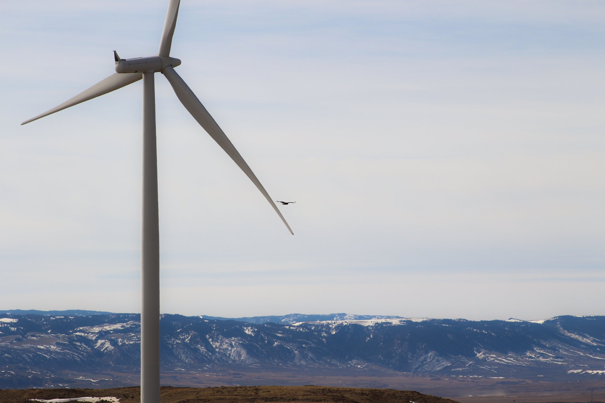
By detecting a bird as far as 1.3 km away and classifying it as a protected species, IdentiFlight empowers wind farm operators with critical visual and quantitative data needed to reduce or avoid collisions.
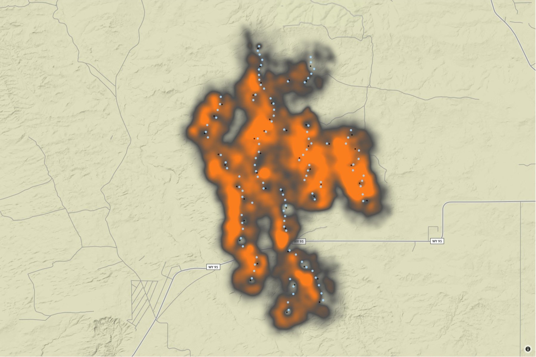
Depending on project scope and goals, IdentiFlight can be installed as a single station for monitoring and data collection or as multiple stations to provide full coverage for an entire wind farm. The siting process is a critical point of collaboration where ecological, geographical, and technical aspects are taken into consideration.

Our journey to targeted curtailment and wildlife conservation
Most IdentiFlight customers experience less than 1% power generation loss per year, even at our most active sites.
Your journey to protecting nature while maintaining energy production starts with us.
Detection
The IdentiFlight system is constantly scanning the skies, analyzing thousands of wide-field images with its eight-camera array. As the wide-field-of-view cameras detect movement, a pan-tilt unit (PTU) positions the high-resolution stereo cameras towards the bird, tracking its flight path.
Classification
IdentiFlight uses high-resolution stereo cameras to determine the distance of the bird from the turbine. Classifying the bird based on our neural network and the bird’s physical characteristics, the system then sends the data to a local database and the Base Station.
These steps occur in milliseconds.
Data Delivery
The Base Station sends the data to the on-site graphical display, the curtailment module for analysis, and to the IdentiFlight Dashboard for real-time operational and data analyses.
Flight Analysis
The curtailment module analyzes bird flight path in relation to wind turbines and determines whether to issue a shutdown command to the nearest turbine(s). Curtailment may be triggered by the bird’s proximity, trajectory, or flight characteristics.
Curtailment (Shut Down on Demand)
If the curtailment module detects a bird is in danger, it will issue a shutdown command through the wind farm’s SCADA network via OPC or other means. For detailed curtailment analysis, the IdentiFlight Dashboard contains a database of all turbine curtailments with corresponding detection details, including date, time, and location. Comprehensive data can be exported for analysis.
THE IDENTIFLIGHT SYSTEM
The IdentiFlight System consists of three components:
• IdentiFlight Stations
• IdentiFlight Base Station
• Dashboard
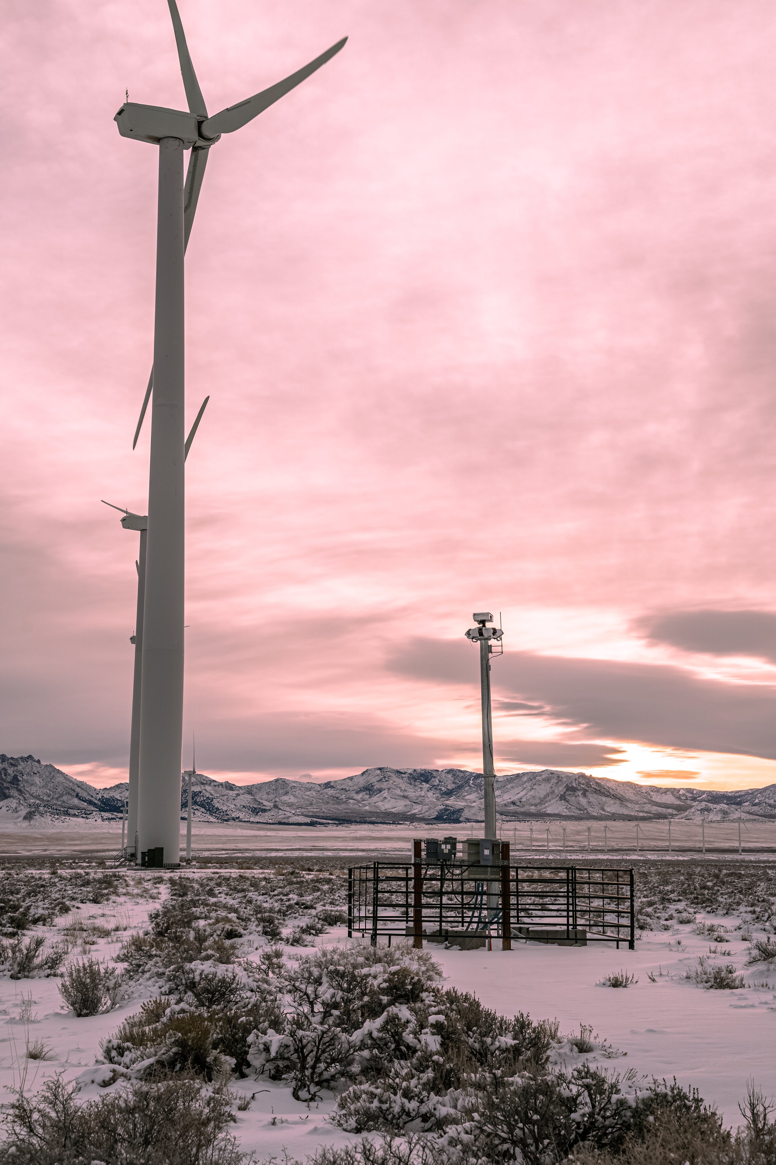
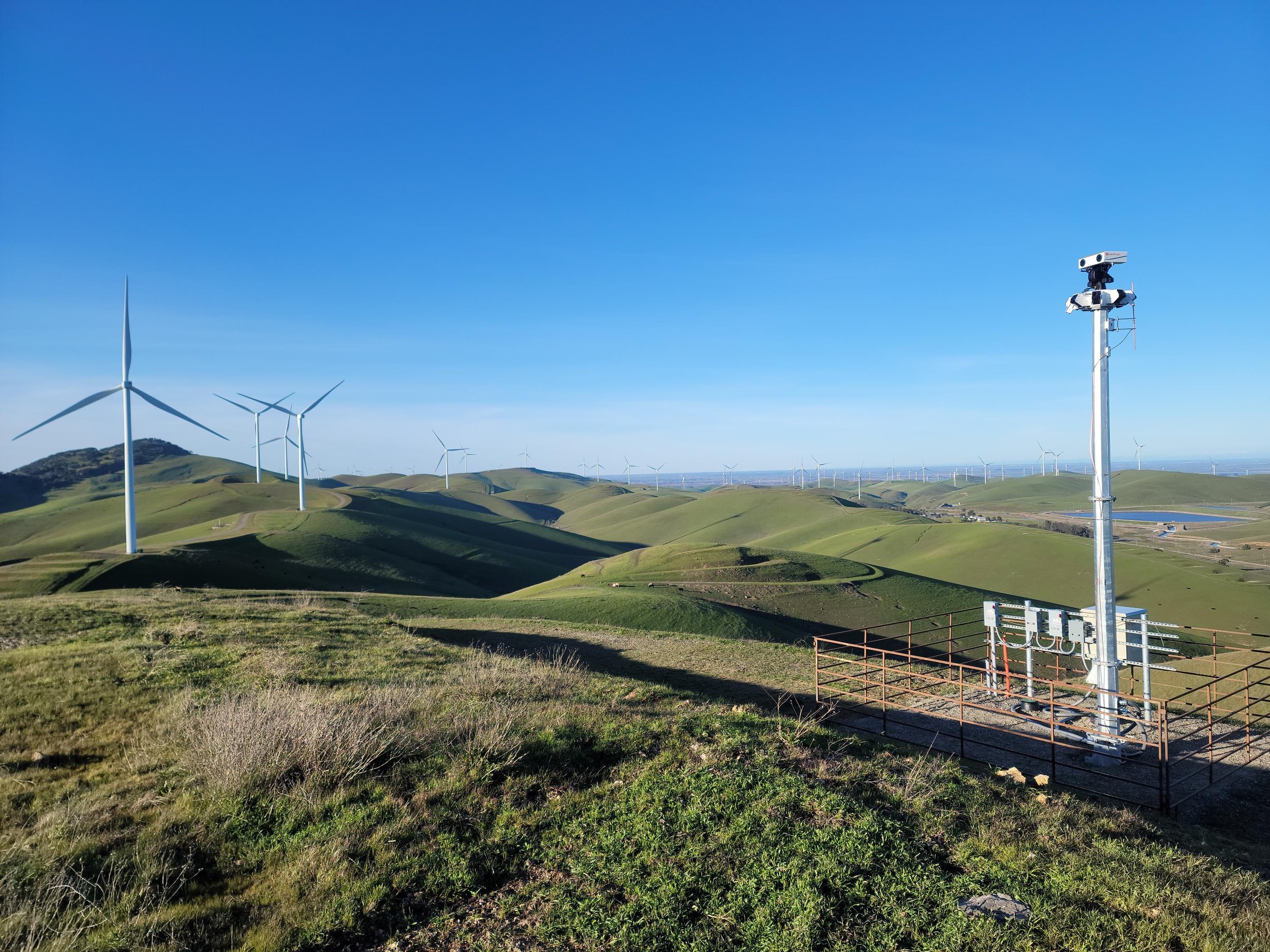
The IdentiFlight Station
An IdentiFlight station includes an imaging head, tower, and control cabinet.
Depending on project scope and goals, IdentiFlight can be installed as a single station for monitoring and data collection, or as multiple stations to provide full coverage for an entire wind farm.
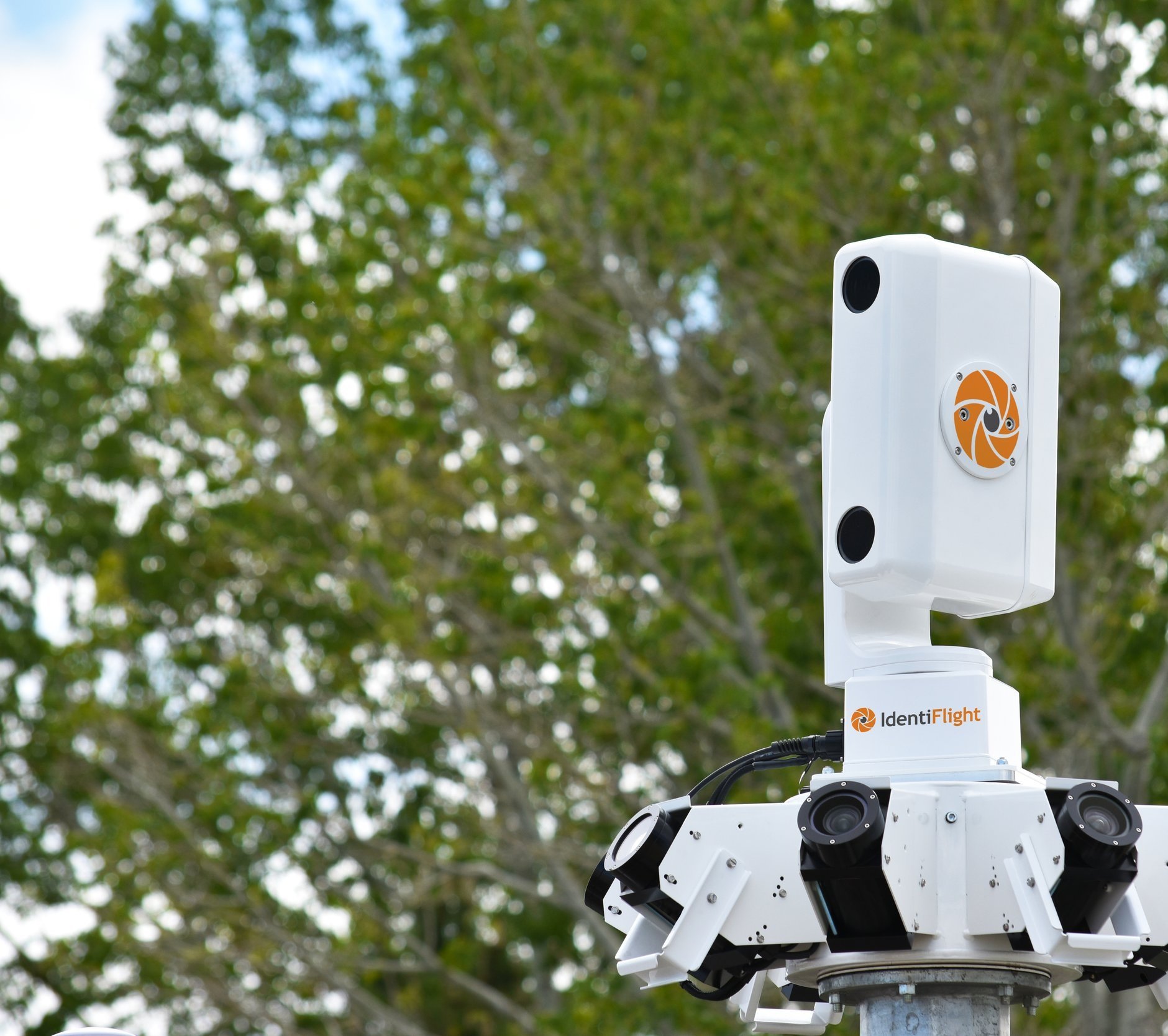
Imaging Head
An IdentiFlight imaging head includes eight fixed wide-field-of-view (WFOV) cameraswhose primary function is detection. Birds are detected within the 1.3 km hemisphere of coverage, and movement and speed are evaluated. Other flying objects are excluded.
As the WFOV cameras detect movement, a pan-tilt-unit (PTU) positions the high-resolution stereo cameras (HRSC) towards the bird, tracking its flight path. The HRSC determine the distance to and size of the bird, and acquire high-resolution images to determine if the bird is a species of interest or not.
Tower
The IdentiFlight imaging head is typically mounted on a 6 m tower, though some terrain requires taller towers (up to 40 m). Several foundation approaches are available to meet customer preferences.
Control Cabinet
A control cabinet, located next to the tower, contains the power system, computer, and network equipment. Network (LAN) and power are typically routed underground from a nearby turbine through spare fiber-optic cores, eliminating additional networking complexities.
Base Station
IdentiFlight detects and classifies species of interest at a sufficient distance from specific wind turbines to initiate a targeted curtailment of one or more turbines, reducing the risk of a bird colliding with that turbine. The curtailment logic resides on the IdentiFlight Base Station, where signals are sent automatically through the site’s SCADA network for immediate action.
Along with the SCADA network connection, the Base Station has an internet connection (WAN) to provide connectivity for remote monitoring for customers and IdentiFlight personnel. The Base Station equipment is rack -mountable and typically installed in an operations and maintenance (O&M) building on-site at the wind farm.
Dashboard
Streamlined and intuitive, the IdentiFlight Dashboard platform provides real-time and historic data of avian and curtailment activity. In addition, Dashboard gives wind farm operators the tools to analyze trends and generate reports on the IdentiFlight system performance at each site.
Dashboard’s troubleshooting tools detect errors and outages automatically and implement corrections immediately. When issues present higher degrees of complexity, technicians are available to administer timely solutions.
Watch How Dashboard Works
SYSTEM SECURITY
Protecting data and networks from unauthorized intrusion is a key part of the IdentiFlight network design. Since sites have their own cybersecurity policies, Boulder Imaging works with you to tailor a network to meet your policies and procedures.
The IdentiFlight system’s Base Station includes a firewall with a single access entry point through the dedicated or routed internet source from the wind farm corporate firewall. The Base Station’s antivirus software is routinely updated.
Our system architecture and cybersecurity keep you secure.
The shutdown signal must pass through the site firewall and to the recommended exchange server point. The IdentiFlight system interaction remains outside of the SCADA security zone. Additional details on cybersecurity are included in IdentiFlight's system manual that can be shared during the project execution phase.

Install IdentiFlight
Together, we can protect nature in a renewable world.